Methodology
Transparency and Accountability
Read Article
Since Mossy Earth's inception, delivering transparency through technology has been a founding pillar. One of the genuine reasons I set up Mossy Earth was that I had previously been donating to organisations but never really knew how my money was being spent. Duarte and I wanted to do things differently and put all our cards on the table. As such, we have tried to build the infrastructure that enables you to easily and independently verify our work and how it translates to impact. Being open and transparent in this way helps us develop trust and to get members engaged with our projects at a deeper level. Here we explain the different measures we take for this to work.
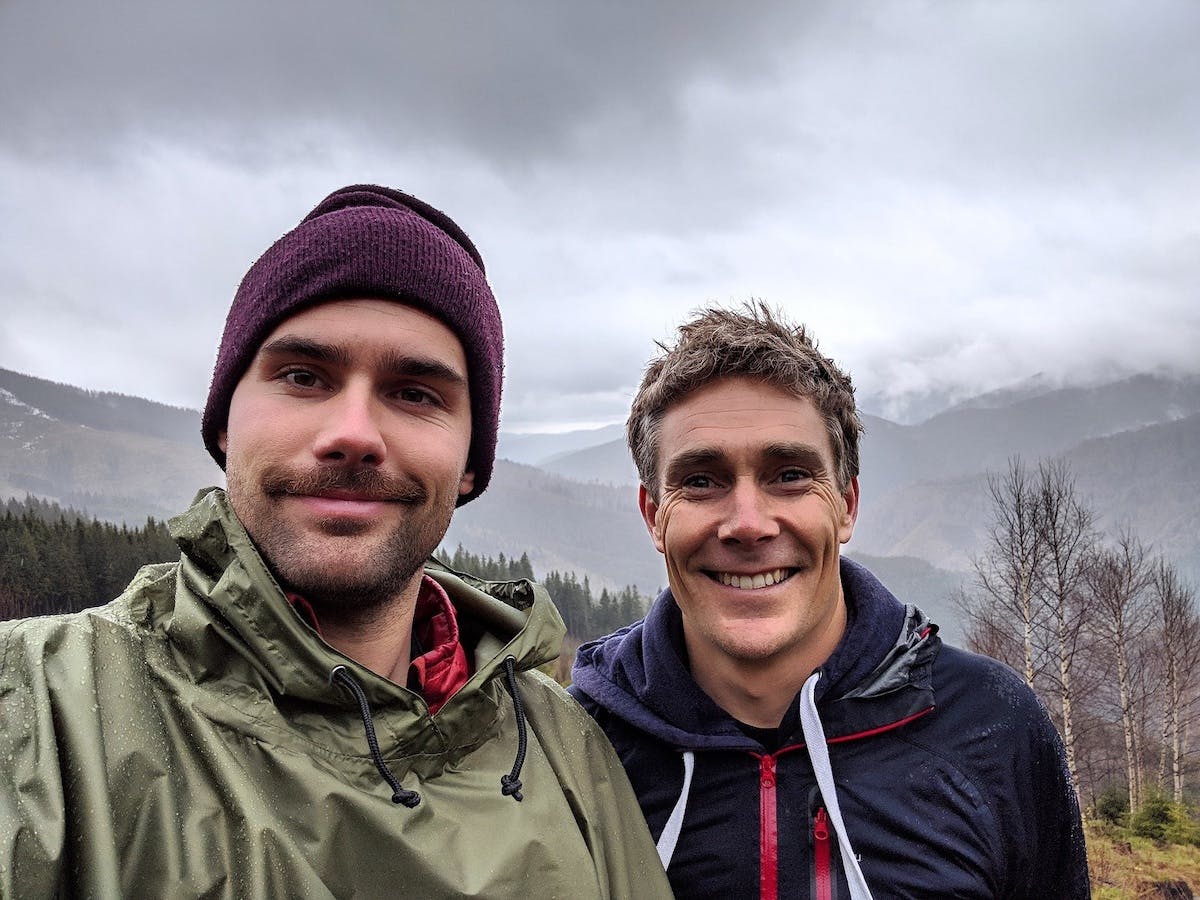
Matt Davies, Co-founder
Every Mossy Earth project starts out with clear objectives for the ecosystems and species it targets. These objectives are researched and designed by our conservation biologists or co-designed with partners, applying a results-based approach integrated with conservation evidence. To understand how we select, design, monitor and report our project outcomes, see our Rewilding and Conservation Evidence methodologies. Following these approaches allows us to report, with more confidence, when a project has a meaningful impact on an ecosystem and/or species. Only after this happens, do we display it on our Transparency dashboard.
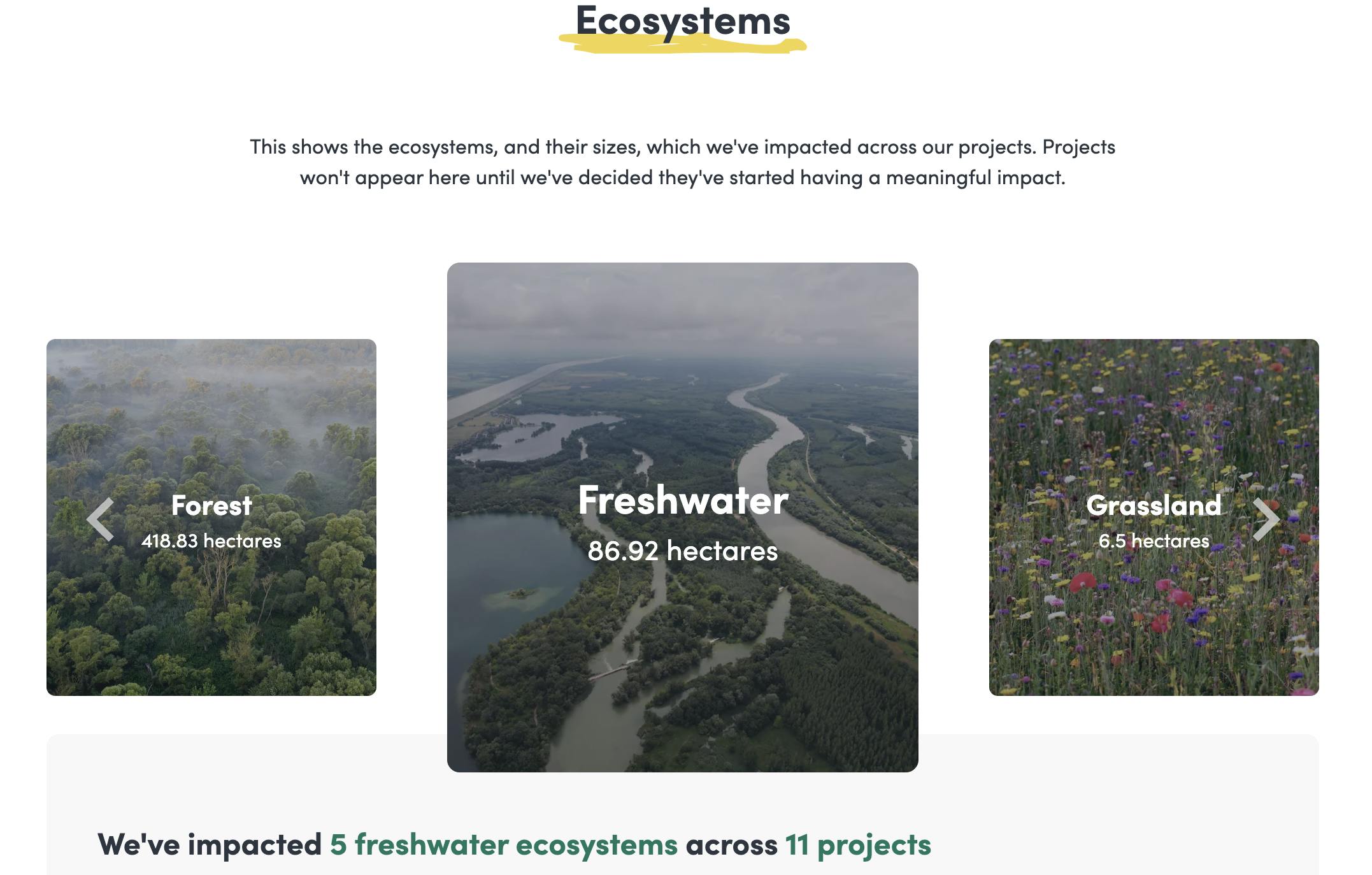
From a top-level view of our impact down to a granular perspective of each action and cost, our Transparency dashboard helps you to follow everything we’ve ever done. We've divided it into four different areas.
At an ecosystem level, we show the ecosystem groups our work is impacting and how much area is affected overall. We have separated ecosystems into the following groups: forest, freshwater, grassland, dryland, marine and coastal. Each ecosystem group is broken down into ecosystem types. For instance, so far our work covers these forest ecosystems: temperate mixed forest; temperate deciduous forest; temperate coniferous forest; riparian woodland; birch woodland; montane woodland; and oak wood pasture. You can drill down even more from there. For each ecosystem type, we show:
This way, you can see our cumulative on the ground action and the resulting impact on the ecosystem as a whole.
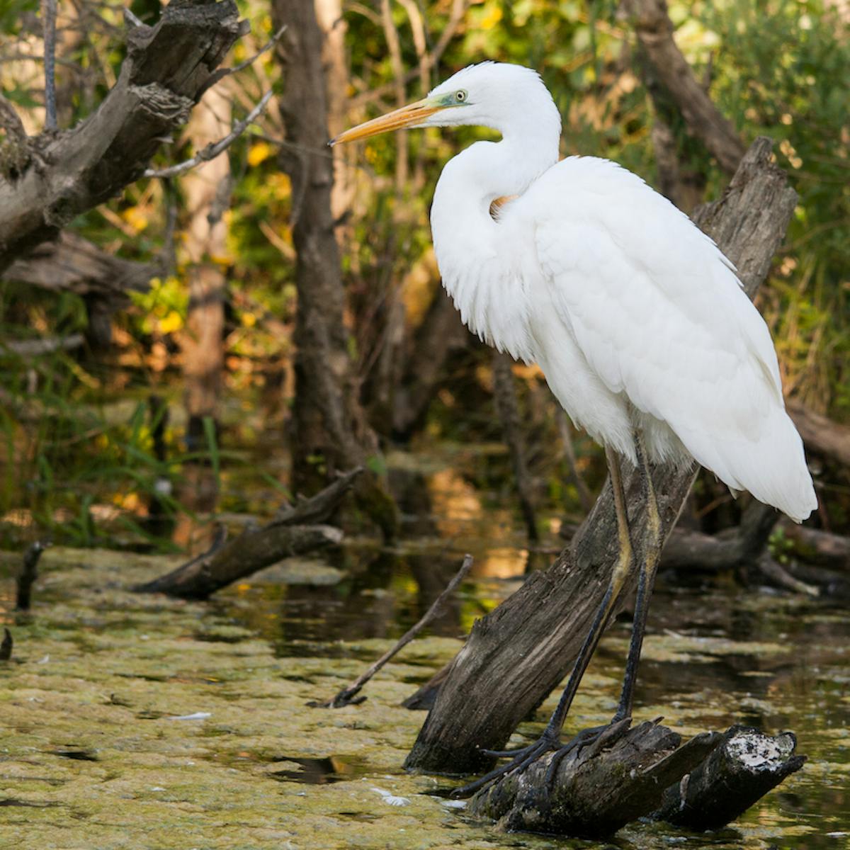
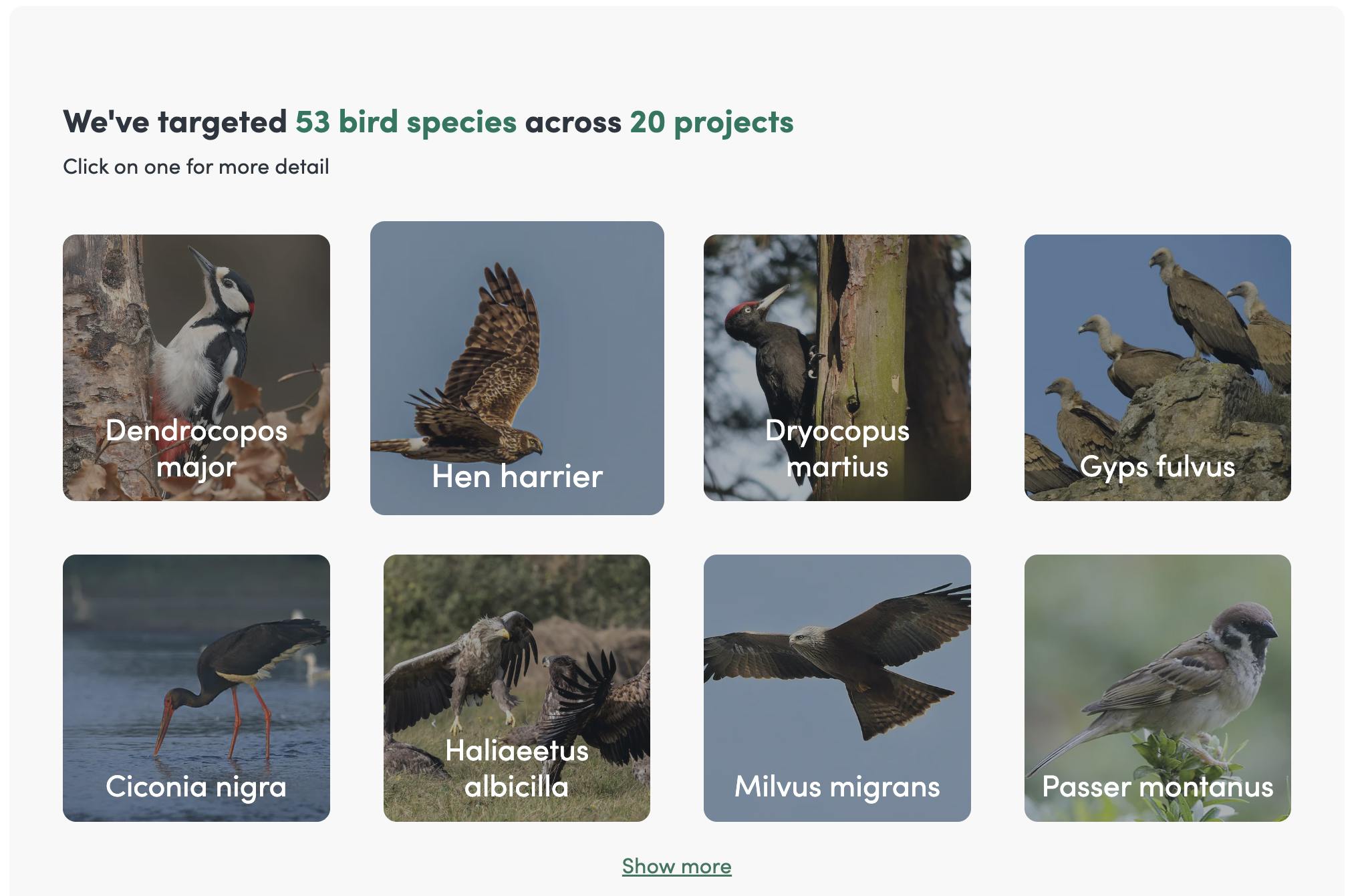
We aim to have a wide impact on biodiversity and ecological function through our projects but often the interventions are expected to benefit individual species, some directly and some indirectly. In terms of reporting our impact, we decided to show all the directly impacted species and a selection of indirectly impacted ones.
Grouping species is done through the following categories: plant, invertebrate, bird, mammal, amphibian, fish, reptile and fungi. Each group is summed by total number of different species, along the total number of projects that target them. To learn more about a particular species, select it to see which projects have helped them and how. Test your knowledge of species' scientific names by hovering over the text to see the difference between a species' common and latin name. There are hundreds of species already recorded on the dashboard. Explore to your heart's content!
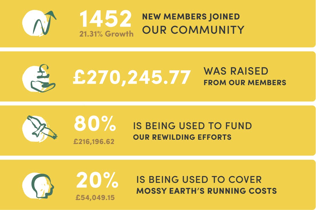
Every quarter, we publish a report to provide you with an overview of how our fundraising is coming along. We outline the highlights of each period including our total number of members, the value of our combined contributions and how much of this goes to its intended purpose. You will also see the detail behind our calculations of our monthly rewilding budget.
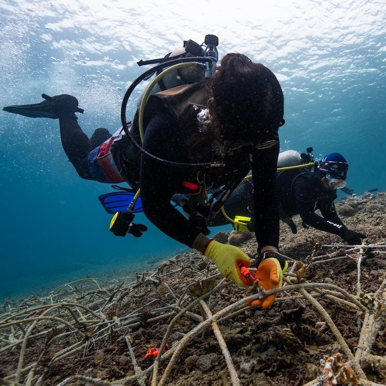
Track everything that happens on the ground at our projects in this section of the dashboard. Every month, our biologists report back on all activity from out in the field. Whether that’s conducting baseline surveys, removing invasive species or reintroducing species. This table displays all the actions being carried out to progress towards project outcomes. It is purely a record of these events. For more information, members receive an Action Impact Card in their account describing the intervention in more detail.
Project costs are reported on our Transparency dashboard to show all costs incurred during a project’s lifetime. The types of costs vary depending on the project but we generally receive invoices for equipment, materials, travel, staffing and specific interventions like earthworks, which are all described within the budgets of our project management plans. Similar to project actions, project costs appear in a more descriptive format in the membership account.
Our Transparency dashboard is available for everyone to access.
Every project has its own story. Keeping you involved at each stage of these stories is an essential part of being transparent. To do this in an engaging, accessible and accurate way, we have chosen a variety of different mediums. This includes:
We strive to give you a clear picture of what is happening. This means sharing our successes but also being frank when things don’t go according to plan. Working under these values is one way we aim to demonstrate our commitment to being open and transparent.
We are an action and results oriented team and believe many of our community are motivated in similar ways. With this in mind, we knew it was important to somehow capture every individual member’s impact on nature with us.
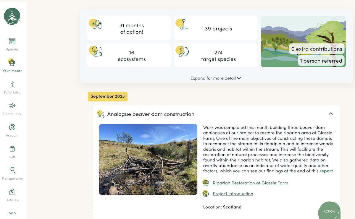
As part of the membership account, individuals and businesses can track their impact on nature through a personalised dashboard. This provides members with an overview of their impact on ecosystems and species. Information is presented so members can see the split of ecosystems by type and the total number of species from each species group (with images).
Project actions are also displayed in the account allowing members to follow all the fieldwork they support each month. These Action Cards provide a description of on the ground events with imagery. Additionally, members receive monthly Cost Cards and Project Pot Cards. Both describe how we have spent or intend to spend our membership funds on projects.
In this section, we explain where to dive deeper and explore the inner workings of our projects.
Firstly, on our project pages we outline the story - a timeline of events, why the ecosystems and species we’re targeting are important, the cost of inaction, as well as our plan and vision for the project.
Within the page you can find our project management plans. These documents detail all the considerations of planning a project such as:
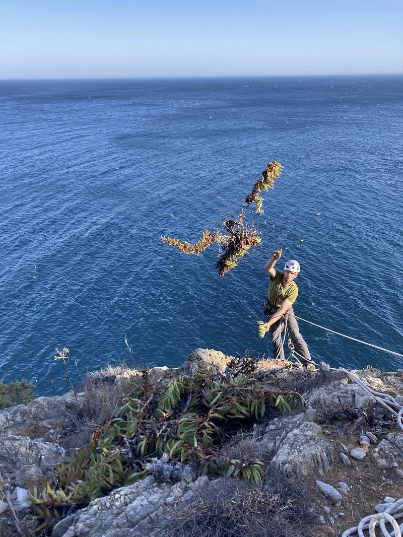
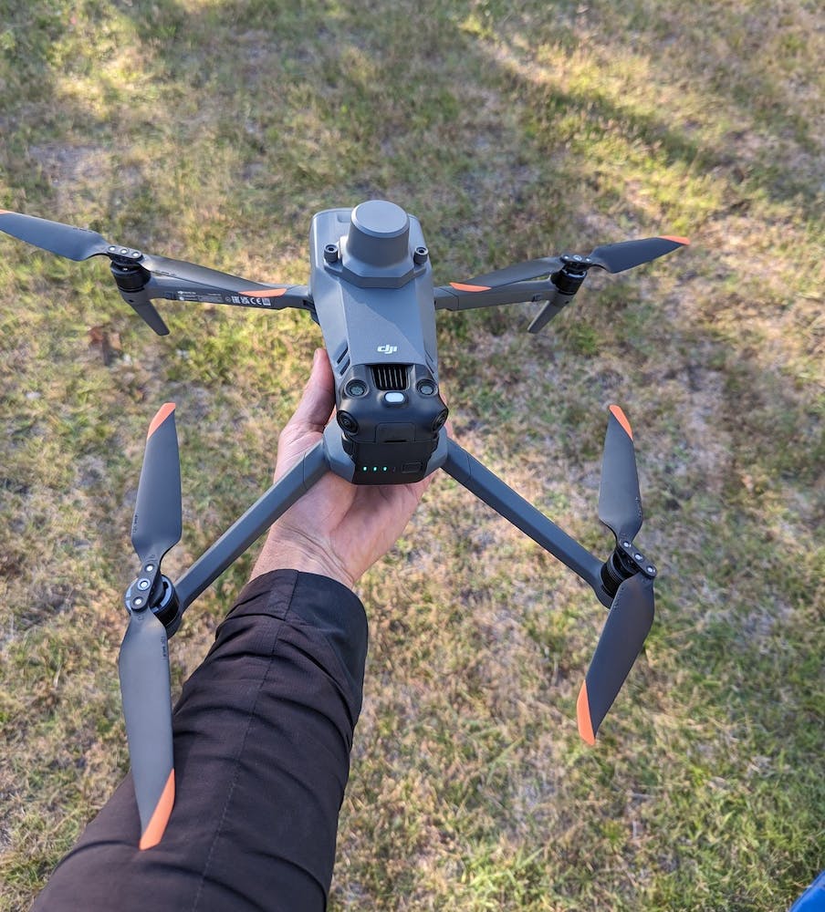
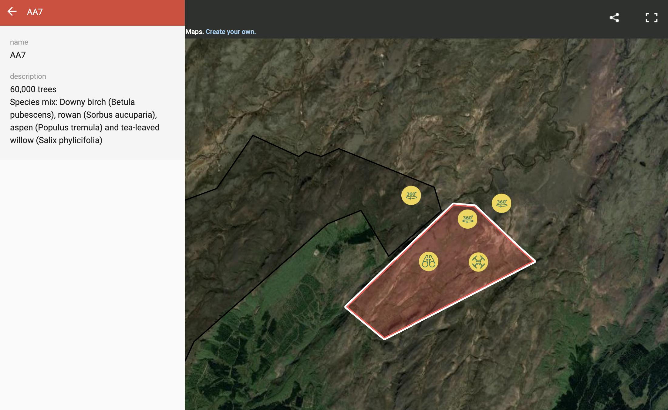
For each and every one of our planting areas, we map the area and record the number of trees planted and the species mix. We also provide GPS coordinates, drone flyover footage, and aerial 360° images of the planting areas, which is available on our maps on each reforestation project page.
Our aim is for users to be able to see where trees have been planted and how that fits in with the wider landscape restoration efforts. There is also the possibility for any member or customer to visit the planting area themselves and verify in person that the trees have been planted. Some of them are quite a way out there in the wilderness but it makes for a fun hike!
For logistical and financial reasons, we plant our trees in batches in seasonal planting periods and always finish assigning each batch of trees before moving on to the next batch to ensure additionality. For practical reasons, we are only able to provide the video footage and imagery of one planting area - the area where the majority of trees are being assigned.
To close the transparency and accountability loop, we invite members to contribute opinions and we make ourselves available in the following ways.
We want to give our members a voice on the direction Mossy Earth should take on key issues. As such, we ask for members’ approval or disapproval of our reporting and gather opinions on important questions in membership votes. The idea is to make the membership more democratic in the long run so our vision is aligned with our closest supporters. Through this approach, we feel we can have the greatest impact together.
We also make in-depth videos to share and discuss the results of the vote and to reply to our members' most burning questions. These long form videos are the place to go if you are curious to know (in more depth) how we are thinking about our work and why we make certain decisions.
We love learning that our projects stoke curiosity and hearing thoughts on them. If you have a question or simply want to reach out, feel free to get in touch through email, social media, our discord or via the membership account. In the account, you can engage in conservation with our biologists and community to discuss topics raised in the project updates. Finally, there is the option for members to book a good old-fashioned call with one of the team, we love to chat to members!

The growth of our community has brought fresh eyes and numerous suggestions on how we can improve our work and its reporting. We have welcomed this and have implemented the transparency dashboard, membership vote and membership report as additional transparency and accountability measures to act on these suggestions.
There is still work to be done, however, to get to the level of transparency we hope to have. New ideas we are currently working on include satellite monitoring for area-based projects and hiring an external accounting firm to audit our spending. For now, if you have any questions, reach out and we will be happy to help.