Methodology
Carbon Footprint Calculator
Read Article
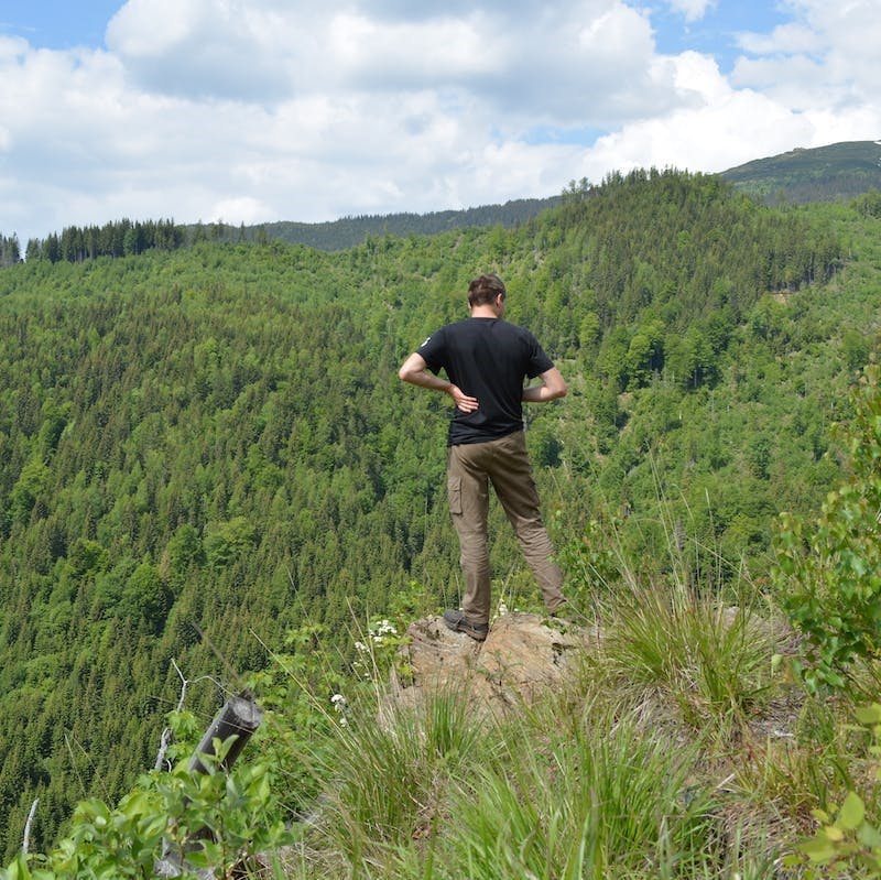
Reforestation projects come in many forms, from the creation of urban green spaces to large-scale monoculture plantations. At the heart of every Mossy Earth reforestation project is a simple but powerful goal - to restore native, wild forests. That means we only support projects that plant native trees where they would grow naturally. We typically plant on land owned by our partners under various states of protection. Before deciding whether to support a project, we carry out a systematic selection process and check that the project meets the following criteria.
Does the project help restore ecosystem services and biodiversity conservation and combat climate change?
We support projects that aim to restore ecosystem services, conserve biodiversity and combat and mitigate the impacts of climate change. Our reforestation projects are not just about increasing tree cover. We look for projects that take into account species diversity and functionality, how trees can provide ecosystem services like soil stabilization and water purification, and their role in providing habitat for local flora and fauna. We also look for projects that consider how the project can help combat and mitigate climate change. Not all reforestation projects are equal and improper design can actually contribute to increased carbon emissions. Our reforestation projects are an important part of our wider rewilding efforts, which is why we select reforestation projects that will, above all, help to rewild degraded landscapes.
Is the ecological problem and proposed solution supported by sound scientific evidence and ecological theory?
Each project must demonstrate a thorough understanding of the ecological problem and outline how the project activities will address these issues. The cost of inaction should be clear and in line with our objective to restore wild forests. In order to ensure that our members’ support has the greatest possible impact, we only support projects that are grounded in science. That means that project objectives and activities are supported by strong scientific evidence and monitoring.
Does the project fit with the wider context of landscape restoration for the region/area?
Rewilding degraded landscapes is at the heart of our reforestation projects. Our reforestation projects therefore take a landscape-scale approach to restoration. Our trees and planting areas are not treated in isolation, but rather as a whole. This means that when making decisions on what species to plant, where and how to plant them, we take into consideration how these activities will shape the wider landscape.
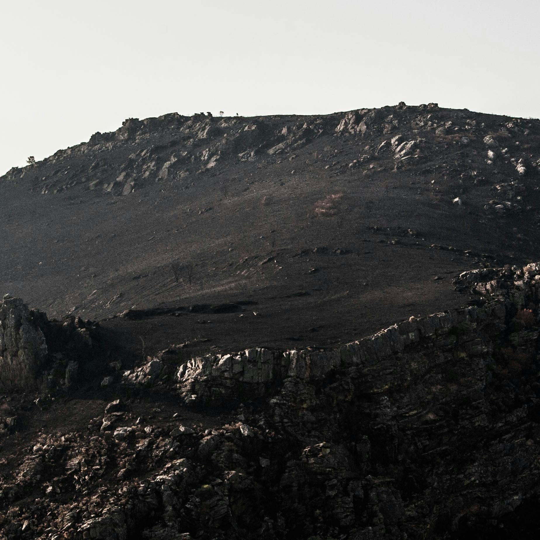
Does the approach display an understanding of the drivers of forest loss and have they been addressed?
In order to effectively restore forest landscapes, it is essential that the drivers of deforestation and degradation have been addressed. Whether it was land clearing for agriculture, harvesting for timber or high densities of herbivores, projects should address the threats that drove the original forest to decline. The project should also identify and address any new threats that could prevent future declines in forest cover and habitat quality of the newly restored forests.
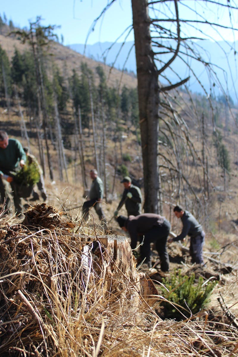
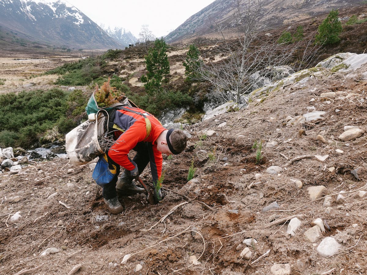
Once a project has been selected, a reforestation management plan is drawn up to outline the particular objectives and activities of the project. We identify what tree species will be planted, where, when and the appropriate planting methodology for the site. The species are selected for diversity, functionality and site specific requirements. Across our projects the specific details of the project vary in line with the ecological context. Things like tree diversity and density vary between the different forest types, from the relatively diverse woodlands at our Irish and Scottish projects to the more homogenous conifer forests of the high-altitude Southern Carpathians. We plant our trees in large batches during the best planting season, which may vary depending on the site conditions, to maximise efficiency and survival rates. While some of our projects source their trees from independent nurseries, others grow the trees in their own nurseries.
Regardless of these differences, one thing our projects all have in common is that decisions are made to maximise the probability that our newly restored forests will survive in the long-term. That’s why across our projects we identify a time period after planting in which to replant any saplings that don’t survive. This period varies between 3-10 years and is intended to balance maximising sapling survival and the natural dynamics of the ecosystem. After this initial replanting period, tree mortality is accepted as a natural part of a healthy functioning forest ecosystem or, in extreme cases, the result of an unforeseen natural disaster (e.g. fire or disease outbreak). Another common thread across our projects is a reliance on local employment rather than volunteers for the land preparation and planting activities. It's important to us that local communities benefit from a rewilded landscape, which is why we make sure our projects provide sustainable livelihood opportunities for the local community.
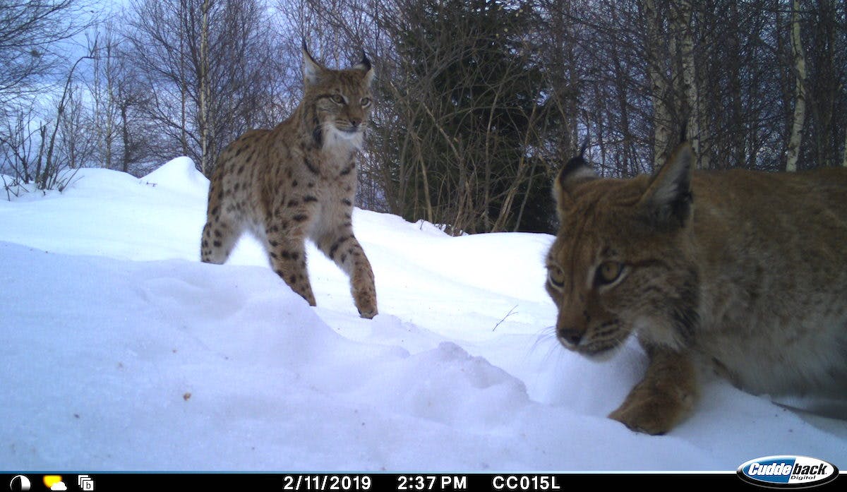
All our planting areas are mapped and stored in a GIS system. This enables us to monitor survival rates and other ecological indicators of forest health in the long term. Survival rates are determined from a sample of the population and used to inform replanting numbers. Tree numbers and species lists are also recorded for each planting area alongside a sample of aerial and tree imagery and made available to members and uploaded to public project maps. These photos will serve as “before” photos to compare against future photos, enabling us to visually monitor tree growth. Since rewilding is a core objective of our reforestation projects we also monitor the wildlife that occurs in the project area. Given the limited capacity for young forests to support wildlife, camera traps are installed in locations within the project area that offer better quality habitat and are close to where we are planting. This allows us to record the species that will benefit from increased forest cover, habitat quality and connectivity.
How can I be sure you are planting my trees?
Transparency is paramount to us and we go to great lengths to ensure that you are able to evaluate our work, including the polygon of the planting area, aerial imagery and videos of the newly planted areas and monthly updates. As a member, you can also contact us to chat with the team to answer any questions you might have. In addition to this we are working on some additional measures we hope to launch in due time such as live-streaming planting, detailed mapping, 360 degree photos and aerial imagery.
What happens if one of my trees dies?
Once the trees have left the safety and comfort of the nursery and are planted out in the field, they are very susceptible to harsh weather conditions, disease, competition and more and unfortunately some of them will die. During this challenging time, which can be up to 3-10 years after planting depending on the project, we commit to replanting any dead trees. After that, we accept further tree mortality as a natural part of a healthy forest ecosystem, with dead wood playing an important role in providing habitat for a variety of species.
Will I be able to know which tree I had planted?
We know that every single tree makes a real difference to environmental preservation but that it is the forest, not the individual tree, that ultimately matters. As such, we photograph and map out planting area, keep track of them internally, and provide detailed information to our members and customers. We do not mark or label our trees in any way.
How accurate are the maps and can I really find my tree?
Mapping will always have some degree of error, but it our polygons will enable us to accurately represent our restoration efforts and re-visit sites in future for monitoring purposes.
